Chiwaukee Prairie Memories – by Phil Sander
![]()
To make a prairie it takes a clover and one bee,
A clover and one bee
And revery.
The revery alone will do
If bees are few
– Emily Dickinson
![]()
My Halcyon Days
When the advancing tide of early settlers arrived in southeastern Wisconsin, they were greeted by a landscape of rolling prairies and oak openings. Tall waving grasses interspersed with communities of wild flowers made the land very attractive and suitable for homesteading. Prairies in Kenosha County were ideal for farming; and, in fact, a township was named Pleasant Prairie. Soon oxen were pulling the sod busting plows that converted the prairie lands into tillable soil.
Today only a few patches of Wisconsin’s original two million acres of prairie still exist. The largest remaining true prairie untouched by the plow in Kenosha County is called Chiwaukee Prairie and it is located in the town of Pleasant Prairie. It is a wet or mesic (moderately moist) lake prairie and an ecological jewel. Constantly changing wild flowers and grasses bloom from May through October. Bird watchers find it a haven for grassland and other migratory birds.
Here serious students (and some with a more relaxed approach) garner knowledge in nature’s classroom, which offers hands on studies in biology, entomology, geology, ornithology and other sciences. Its setting is an outdoor laboratory for the scholar or the average person to enjoy a quiet place to stroll and discover nature.
Living near the prairie environment has given me an enduring interest in the land, wildlife, history and numerous facets of science related to this very special place. This little book will share some of my Chiwaukee Prairie observations and experiences.
In my growing-up years, one of many haunts to roam and explore was the area south of Kenosha along lake Michigan’s ancient shoreline. Often I recall those pleasure filled weekend hikes with my pals, Cliff and Jack. We started at 75th Street, walking south to Butcher’s Beach (Southport Park) where we swam. Afterward, we would hike to Van Igen’s Woods, Barnes Creek (Carol Beach) and Weyhe Prairie (Chiwaukee Prairie), ending at the Wisconsin-Illinois state line.
We were always looking for new and interesting discoveries. Several times on our hikes we found evidence of former Indian chipping stations, where strong winds blowing over a sand dune pocket had uncovered chert chips and flakes. These remnants were left as refuse by the Indian arrow makers. Stones they had used were found on the beach, cast up on the shore by wave action. Occasionally we would find an arrow or a stone implement.
Searching along the beach, we sometimes stumbled onto pieces of fool’s gold and wave worn driftwood. A prize find was a piece of sassafras wood that probably drifted across the lake from lower Michigan. At times we found the floats from fisher-men’s nets.

In those halcyon days there were no roads or homes along the five mile stretch of the shore south of Kenosha. We had free access to the beach, woods and prairies from 116th Street to the Wisconsin-Illinois state line, and east from the Chicago Northwestern Railroad tracks to the shore of Lake Michigan. Weyhe Prairie (now Chiwaukee Prairie) was a mysterious stretch, an isolated land of swells and swales, tall grasses and cattails that reached over our heads. At times we felt as though we were lost in a prairie jungle. No summer was complete without cookouts and overnight camping next to the lake on the sand dunes.
Migrating birds soared over the prairie during spring and fall. Colorful flowers, which I tried to identify by referring to Spring Flora of Wisconsin by Norman C. Fassett, appeared all summer long.

Development Came
A great change came over the lakeshore property in 1924, when Mrs. Edith Rockefeller McCormick purchased 1800 acres which extended from 80th Street to Tobin Road (116th Street). The western edge was at Hwy 32, nearly a mile from Lake Michigan. Mrs. McCormick’s plan was to build a model city with retail shops, a golf course, a school, playgrounds and marina. Surveyors scrutinized the land. Roads and several bridges were plotted and built. Barnes Creek was rerouted to go directly east from the railroad tracks to Lake Michigan. This exciting gold coast development was named Edithton Beach (after Mrs. Edith McCormick’s first name).
The clubhouse and a nine hole golf course were completed. Later the golf course was abandoned because of wet soil., Moist, undulating land, high lake levels and problems with drainage made home development difficult, so that phase was also held in abeyance.
Luxury homes were built along the high dune areas of the lakeshore. Later, rising lake levels plus violent wave action submerged many lake lots, and parts of First Avenue were. swept into the lake. Homes were undermined and lost, or moved to new locations. Protective barriers of huge stones and concrete that were placed on the shore saved a number of homes.
|
| One of the lakefront homes that was lost was owned by the cartoonist, Bud Fisher. His comic strip Joe Palooka (the boxer) appeared in many newspapers. In 1937 Joe Louis, heavyweight champion, stayed at the Fisher home. He was training to defend his title at the Kenosha Lakefront Stadium.
The Edithton Beach and Chiwaukee on the Lake plans for a model city did not materialize because of the economic crash of 1929. After Mrs. McCormick died in 1932, the ownership of Edithton Beach land went into court as a foreclosure action. A Chicago group bought the land in 1932 for $131,000. This group said it would revive Mrs. McCormick’s dream of a model city, but these plans never materialized either. The Kenosha County Sheriff, in 1937 sold the land for $186,000, plus back taxes. In 1943 during World War II, approximately 845 acres were used as an anti-aircraft training site by a company of soldiers stationed near Barnes Creek. They shot at targets towed by planes over Lake Michigan. |
The Wisconsin State Planning Commission, in Bulletin No. 3, issued in 1936, recommended that the lakeshore land beginning with the sand dunes and extending south to the state line, be acquired as a state park. During the mid-forties, James Wallace, Kenosha City Manager, headed a committee of interested citizens and business leaders in support of the proposal. The Kenosha County Conservation Club also urged the state to purchase the lakeshore properties; but, because of a lack of state funds and sufficient local interest, the project was terminated. At that time no thought was given to the potential for tourism and some felt that Illinois residents would have the most to gain.
| The Edithton Beach properties were purchased by a new group of developers in 1947. Joseph E. Shaffron, realtor and builder, was the principal officer. The new subdivision was called Carol Beach Estates after his daughter. Seven units were platted. Homes were built for both middle class families and the families of business and professional people.The 130 acre sand dune area, which was north of the wooded subdivision, was sold to the Wisconsin Electric Power Company for the development of a future power plant. The plant never materialized. Instead it was built six miles west with an industrial park incorporated in the plan. Water for the power plant comes from Lake Michigan and is sent to the plant through the pump house located on the shoreline in the sand dunes. The Kenosha Waste Water Treatment Plant purchased 27 acres from Wisconsin Electric for a sewer plant expansion program in 1990. In 1993 Wisconsin Electric graciously donated 62 acres of sand dunes to the Wisconsin Chapter of The Nature Conservancy. |
|
|
| Looking back, my thoughts wandered to the many days when I had roamed through the Chiwaukee Prairie, watching migrating birds and prairie mammals, and photographing colorful flowers, always trying to produce a better picture. Often I heard the peenting (sound created by rapid wing beats) of the woodcock as it skydived above the prairie. I thought often of the campfires on the beach, where I had enjoyed conversations with friends. Watching falling stars was a timeless pleasure that this wide open yet secluded domain offered. This wildlife area was accessible to all who enjoyed the outdoors. This is why I became a prairie advocate, hoping that this undisturbed land would remain in its natural state as a haven of biological diversity. Occasionally I walked the prairie with Norbert Roeder, curator at the Kenosha Public Museum. He helped me identify the wildflowers and grasses by their common and scientific names. Roeder, also a prairie supporter, often spoke about preserving this rare natural area. |
Preservation Begins
| In the early spring of 1964 Al Krampert stopped at my home for a visit. He was excited after seeing the profusion of shooting stars and other flowers that appeared on the prairie swells in a serpentine formation. We talked about a wide range of subjects, fishing, traveling and ecology, but the main topic was the future of the prairie. Krampert asked, “Phil, is there anything we can do to save the Chiwaukee Prairie?””Well, Al,” I responded, “to save this large a tract of land it would take the state, or a private organization with the available funds to purchase some 300 acres. The site is about one-half mile wide by one mile long, and is divided into lots averaging 60′ by 130′. Each lot is individually owned.
“Krampert then asked me, “Do you know of any state or environmental group that would be interested in acquiring the Chiwaukee Prairie? You know it is one of the last prairie remnants left in Wisconsin.” |
Map Key No. 2 |
I replied, “The State Department of Natural Resources made an effort to acquire the prairie, but it proved too costly because of rising land values and scattered owners. So they gave up on the project. I do know of an organization called The Nature Conservancy, which is a national group with state chapters whose mission is to preserve rare natural and scientific areas.”
I told him that Paul Olson, whose office was in Madison, was the Director of the Wisconsin Chapter. Krampert said he would call Paul to tell him about Chiwaukee Prairie and would keep me advised. His contact with The Nature Conservancy was favorable. Olson told Al that the organization did help to save valuable prairies with a high inventory of native plants and that Chiwaukee Prairie fell into that category.
As homes began to dot the prairie and undisturbed lands shrank, interest in the prairie’s preservation grew. In early 1965 promoters announced plans for a large marina in the southeast comer of the prairie at the Wisconsin-Illinois state line. The development was named Pompeii on the Lake. When plans for rezoning came before the Kenosha County Board of Supervisors, local and state environmentalists were opposed to the marina and its plans to dredge and channel a basin into the prairie lands.
On the night of the county board meeting a blustering snowstorm swept the area, but supporters of the prairie came out in full force. It was encouraging to hear people who opposed the rezoning. Dr. Darnell from Marquette University, E. Krueshke from the Milwaukee Public Museum, and Kenneth Dearolf fi7om the Kenosha Public Museum led the opposition. Dr. Orie Loucks and Dr. Hugh Iltis, who came from Madison, spoke against the proposed marina. From Racine came staunch supporters Louise Erickson, Dr. Von Jarchow, Dorothea Kuehnl and many others. Krampert and I gave our views. Other Kenosha people present and strongly opposed were Dorothy McAleer, Gen Crema, Fred Schmidt, and Dr. James Olson, a professor of botany at the University of Wisconsin Kenosha Center.
The marina was represented by attorney Earl D. Morton, who gave a glowing account of the marina plans. The developers would spend $12 million, perhaps even $20 million, to construct 1,000 boat slips, a large motel and recreation facilities, including a golf course. John Esterbrook, who owned a large tract of the prairie, spoke about building homes which would add to the tax base. The marina promoters convinced the county board, and the new zoning was granted.
After the meeting a group interested in preserving the prairie plants met in the corridor. Louise Erickson, pad in hand, collected everyone’s name, address and telephone number. Dr. Olson offered the group a meeting place at the Kenosha Center. Hugh Iltis gave his file on Chiwaukee Prairie to Krampert and said, “Here, it’s up to you people locally to save the prairie.”
| Several weeks later a meeting to organize, a committee of conservation minded people from Kenosha and Racine was held. Foremost in our thoughts was our determination to proceed to save the prairie. Krampert was elected chairman. I was named vice chairman. Dorothy McAleer and Ruth Teuscher were elected secretary and treasurer respectively.
Professors James Olson and Barrie Hunt of the University Center were selected as advisors. Other members of the group included Louise Erickson, Ed Prins, Dorothea Kuehnl, Gen Crema and Ken Dearolf. The group named the organization the Kenosha-Racine Project Committee Wisconsin Chapter of The Nature Conservancy. Krampert and his committee were convinced that this treeless relic. of approximately 300 acres had important ecological and scientific values. They developed and supported a plan to acquire and preserve the prairie. Someone quoted Aldo Leopold, well-known naturalist, who said, “The first prerequisite of intelligent tinkering is to save all the parts”. Subsequent meetings were held in the Kenosha and Racine University Centers. |
|
In May of 1965 Krampert and I spent an entire day walking in the Chiwaukee Prairie, checking plat maps, trying to find out who owned the various parcels and how much was paid for each lot. The difficult questions were: How would we contact more than 400 individual property owners? Would these owners, scattered all over the continent, be willing to dispose of their lot at a fair market price? How would we pay back a loan to The Nature Conservancy? Would environmentalists and the general public support our project?
|
| After discussing the pros and cons, Krampert, seeking my support, said, “Phil, what do you think we should do?”
I answered. ‘Let’s go ahead and purchase the first parcel that’s available. That will get our foot in the door.” With enthusiasm, he said, “Fine! Let me talk to others on our committee and get their opinion. I will then go to the Madison office of The Nature Conservancy.” Krampert found that a narrow 15 acre parcel along the western edge. of the prairie from 116th Street to the state line was for sale by the Northwestern Loan and Trust Company for $5,500. It was a mile long strip that ranged from 100 to 300 feet wide. Later this property was deeded to the University of Wisconsin-Parkside. |

The Chiwaukee Committee held meetings at the Kenosha and Racine University Campuses to discuss plans and recruit new members. Krampert soon announced that the national Board of Directors of The Nature Conservancy had granted our request for a $5,500 loan to purchase the 15 acres and get the preservation project started. This was the first land the Committee purchased in June 1966. This was the strategic means of “getting our foot in the door.”
That news motivated the Committee to plan to solicit funds from the public in Kenosha and Racine to preserve the prairie, a first for a cause of this type. We wondered how we could convince people to donate to save a prairie. How would people respond? Frankly, we didn’t know.
The fund raising campaign to repay the $5,500 loan was started that month with a dinner organized by Gen Crema at the Woman’s Club of Kenosha. This was followed by a series of fund raising luncheons, appeal letters, campaign literature and other money raising efforts under the auspices of the Committee. Dr. James W. Olson, botany professor at the University of Wisconsin Kenosha Campus, lectured to service clubs. The news media gave good coverage and described Chiwaukee as a critical natural area desperately in need of protection and conservation. This writer took the first colored slides of the prairie’s plants, birds and flowers and used them in presentations. Individuals, firms and organizations supported the campaign.
Programs were presented to larger public audiences in high schools in Kenosha and Racine. They were given by Murl Deusing, a naturalist and ornithologist with the Milwaukee Public Museum. Admission charges were used by the Committee to purchase land.
Despite those strong and time-consuming attempts to sell The Nature Conservancy program, funds came in ever so slowly. At times it was discouraging. The Committee had a goal of $50,000, but contributions came to only $8,000. The result was a letdown.
Then we had good news! The Dr. James Zimmerman family of Madison made a bequest to the Wisconsin Chapter of the Nature Conservancy for $10,000 for land purchases in the Chiwaukee Prairie. The gloom that hung over the Committee disappeared, and additional funds continued to come in. By the latter part of June the initial purchase of 15 acres had grown to 83 acres. Orie Loucks, of the University of Wisconsin-Madison, petitioned the U.S. Government for a grant of $18,500 to permit the University to buy land in the Chiwaukee Prairie.
In 1967 the area was dedicated as a State Scientific Area by the Department of Natural Resources, and as a National Natural Landmark by the U.S. Department of the Interior. Chiwaukee Prairie is one of the last unbroken stretches of lakeside prairie in Wisconsin. Its color palette of native perennials was now in the process of being saved for future generations.
Krampert did much of the advance work to get the prairie project off the ground. He wrote letters to lot owners telling of the scientific and educational values of the land. Krampert and I went to Chicago to talk with Interested sellers. Some agreed to sell at a proposed price of $350. Others wanted to keep their lots for retirement homes. Owners were scattered all over the continental United States, and as far away as Hawaii and Portugal. The man in Portugal after being contacted by Krampert, sold his three lots for $450. Krampert can tell many stories about convincing owners that their property would be better utilized as part of a scientific preserve. However, about 1977 Al Krampert retired from his business and relocated to his new home in Tillamook, Oregon. While the prairie lost a great environmentalist, Krampert redirected his efforts to Oregon’s natural areas.
In 1979 The Nature Conservancy office sent 400 letters to land owners describing the significance of the prairie. Several of these lot owners donated their property as a result of this effort. The, Committee was dissolved when it was felt that expertise in land negotiations, correspondence with lot owners and legal work must be done by a professional staff with volunteer assistance. However, some of the Committee members continued with programs, stewardship and prairie tours.
Past directors of The Nature Conservancy, Brent Haglund and Russell Van Herik, paid special attention to the progress of land acquisition at the prairie in addition to overseeing 40 or more, other projects throughout the state. Van Herik told Kenosha and Racine business and community leaders that Chiwaukee Prairie was the richest mesic prairie in Wisconsin. Other prairie supporters made presentations to citizen groups emphasizing the need for preserving this natural area.
In order to continue the early grass roots Preservation efforts a new group of prairie enthusiasts from Racine and Kenosha launched an organization named Chiwaukee Prairie Preservation Fund in 1985. Officers were Joan H. Rohan, President, Donna Peterson, Vice-President, Gary Zumach, Treasurer, and Linda Manning, Secretary. They offered assistance to the Wisconsin Chapter of The Nature, Conservancy and the Department of Natural Resources in acquiring prairie lands, stewardship and tours. This hardworking group sponsored a number of successful fund drives. The sale of donated art works resulted in the purchase of five lots in the Chiwaukee Prairie for $3,500. Gatherings were held at the University of Wisconsin Parkside and Kemper Center to gain new friends and reemphasize the importance of preserving the prairie. Money for land was derived from grants, fund raising letters. sales of books, stationery and paintings, as well as program presentations.
| The Preservation Fund broadened its objectives and acquired land west of the railroad tracks known as the Barnes and Iris Prairies. The Preservation Fund and friends of the prairie have helped Nancy Braker, of The Nature Conservancy staff, and Tom Becker, of the Department of Natural Resources, in conducting tours, prairie burns and clean ups. Gen Crema trained several classes of docents to assist with tours. This dedicated group has preserved much prairie land through patience, determination, negotiation and perspiration.
The prairie has been toured by hundreds of interested people. A dozen universities have used the prairie for a variety of studies. Dr. Eugene Gasiorkiewicz, emeritus professor of biological science at the University of Wisconsin-Parkside, described the prairie as a multifaceted jewel. He produced a manual, Chiwaukee Prairie Plant Checklist. Revised in 1986, it gives the scientific and common names of prairie plants found at Chiwaukee Prairie. |
Map Key No. 28 |

When Peter McKeever became the state director of the Wisconsin Chapter of The Nature Conservancy, he was very enthusiastic about Chiwaukee Prairie and accepted it as an exciting challenge. On June 22, 1990, he announced a landmark event. The Nature Conservancy acquired a tract of land in the southwest portion of the prairie owned by the Prairie Harbor Yacht Club. After 25 years of patient effort, these 49 acres of priceless prairie were happily added to the preserve, assuring them of permanent protection.
Chiwaukee has survived because of dedicated individuals and many generous supporters, both local and state wide. The University of Wisconsin-Parkside and The Nature Conservancy now co-own 226 acres or two-thirds of the prairie. Approximately 168 lots remain in private ownership at the end of 1994. Their purchase is necessary to the integrity of the prairie.
The Chiwaukee Prairie area is a precious resource, where, in future years, students, professors and everyday folks can go, and, in the words of Aldo Leopold:
“…on a still night sit quiet and listen, and think hard of
everything you have seen and tried to understand.
Then you may hear it – a vast
pulsing harmony – its score inscribed on a
thousand hills, its notes the lives and deaths
of plants and animals, its rhythms spanning the
seconds and years.“
![]()
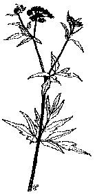
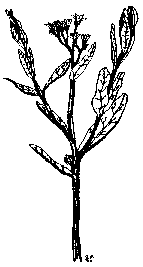
Prairie Plants
Today Chiwaukee Prairie lies serenely in the southeast comer of Kenosha County. One can come here to commune with a genuine tall grass prairie. It is a living community dominated by native grasses and colorful forbs (broad-leaved flowering plants).
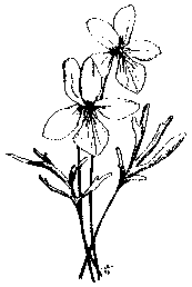
When Lake Michigan receded thousands of years ago it left a series of sandy ridges which are now covered with plants. The small ridges superimpose on larger ones, paralleling the lake and lying on top of limestone. One of the acid loving plants is the beautiful royal fern. Lime. Lovers abound – grass of parnassus (closeup), gentians, Riddell’s goldenrod and a truly spectacular profusion of shooting stars.Also found here are the four-flowered whorled loosestrife, bluejoint grass, cord grass and a number of rather uncommon sedges (plants indigenous to wet ground). With them grows the sweet grass famed for its use in the almost lost art of Indian basket weaving. Chiwaukee is often called a wet prairie, because of its poor drainage and numerous tiny sloughs containing cattails, roundstem bulrush, blue flag, swamp milkweed, marsh marigold, swamp lousewort, cardinal flower and other water loving plants.
But only feet or inches from these swales, on small ridges and plateaus, prairie species that thrive in drier areas, such as orange puccoon, little bluestem and dropseed grasses, blazing star, and the intense ultramarine blue downy gentian. In between are found many typical (and now rare) mesic prairie species such as red avens (prairie smoke), lead plant, tall bluestem, four milkweeds (including the rare Asclepias hirtella, a tall green plant which blooms in August), early (cream) baptisia, rattlesnake master, flowering spurge, purple prairie clover, Seneca snake-root, yellow coneflower, all three silphiums, seven goldenrods, four asters, arrowleaf violet and golden Alexanders. Five orchids are found here: the fragrant ladies tresses, small yellow ladies slipper, grass pink, bog twayblade and the beauty queen of all prairies, the prairie white fringed orchid.
The numerous swells and swales assure the perpetuation of this diverse plant complex. In dry years the low areas retain moisture, while in wet seasons the tops remain unflooded. Over 475 species of plants have been identified here in their various habitats. Shifting sandy areas favor colic root, lyre-leaved rock cress, butterfly weed, lupine, birdfoot violet and spiderwort. Among southern species just reaching north over the Illinois line into Wisconsin are the pink nodding onion, smooth pink phlox, gayfeather and the chestnut sedge.
Plants associated with limy Lake Michigan shores mingle here with prairie denizens such as the showy yellow Kalm’s St. Johnswort, the dune trailing silverweed, Ohio goldenrod and the intensely fragrant tiny pink savory. On wet sandy sites, botanists seek the rare green false asphodel, while masses of grass-pink orchids and Indian paintbrush excite the photographers.
One of the great curiosities is the absence of trees in this obviously humid region next to the lake. Several factors, no doubt, contributed to this. In the dry years prairie fires may have swept over the area frequently, or it was burned by Indians for various reasons. Wet years may have drowned many tree roots but spared the hardier prairie species. That was the case on the poorly drained Illinois prairie lands in early days. Today’s practice of planned burns has helped to eliminate unwanted trees and to restore and maintain the wealth of precious plants found at Chiwaukee.
Spiderwort
Map Key No. 16
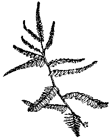
Dominant Prairie Grasses
“Grass – it yields no fruit in earth or air, and yet should its harvest fail for a single year – famine would depopulate the world.”
(Source unknown)

The ever present native grasses, with their abundance of species, their picturesque growth, color and seed characteristics, have been of special interest to me. This resulted in many visits to the prairie. Studies show that tall lush grasses extended just into the southern tip of Wisconsin. Unnoticed and probably under appreciated they offer a wealth of knowledge in the science of agronomy. Like most perennials their growth starts in the spring with a deep root system that defies the prairie fires. Their summers are spent as low tufts of leaves which use energy from the sun to produce flowering stalks. Some individual plants may live for 50 years or more. Grass flowers are scarcely noticeable but produce from several to hundreds of flowers as they cluster at the top of the stem. They do not show their richness until mid-August, as the wiry clumps grow with the passing weeks of sunlight, and as their appointed maturation time nears. In the fall grasses are easily identified. Two species are the most dominant, little and big bluestem (neither of which is very blue). Little bluestem is perhaps the most common of the prairie grasses.
|
|

It grows only a few feet high, initially appearing green-gray and crimson, maturing to a golden tan that lasts through winter. Big bluestem is the rough, shaggy purplish grass. It grows as tall as eight feet, with short clusters radiating from the top like fingers of a hand. Its other common name is turkey foot because of its three branched spikelet.
| Another abundant prairie resident is Indian grass with its narrow, pointed warm yellow flower cluster. It has a luster of gold in the morning sunlight. All grasses begin to grow about the first of May.
Cordgrass likes the wettest part of the prairie and grows to a height of about three feet. Indians used this grass for thatching material and for making floor mats. Leaves must be handled with care, otherwise fingers or hands may be cut. It flowers during the early fall season. Prairie dropseed grows in tufts and bunches. Its short rhizomes and roots usually creep horizontally, and are immediately under the surface. The plant matures and flowers in late September and is considered a minor or secondary species of grass in a true prairie. It is easily recognized by the presence of copious white hairs radiating in all directions at the nodule areas. It is sometimes considered an invader in the prairie. |
Solitude reigns
as one walks
among the grasses.
Prairie Birds
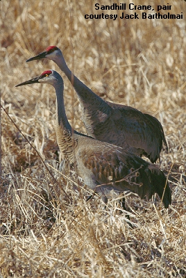
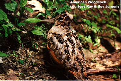
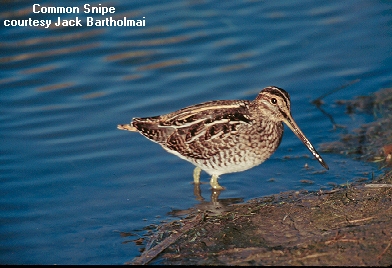
Chiwaukee Prairie attracts many species of bird life. Although sandhill cranes have occasionally made a spring stop in the past, the presence of houses and traffic have deterred them from nesting here. All birds need specialized nesting areas for reproduction. Among the first arrivals in May are the American woodcocks with their nasal calling and peenting. Also fascinating to watch is the common snipe performing his aerial courtship display.
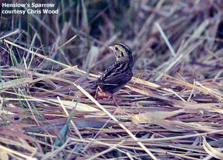
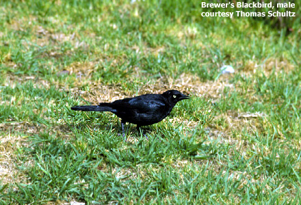
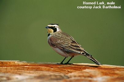
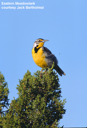
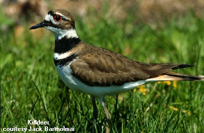
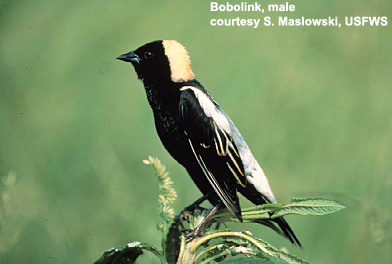
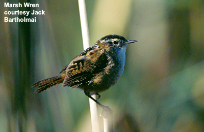
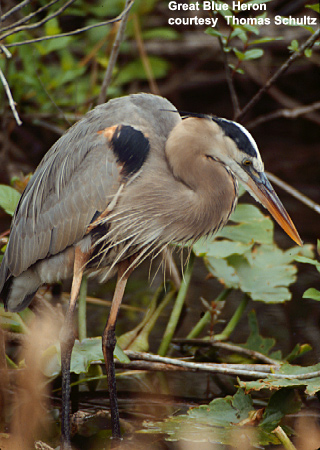
Other feathered friends of wet prairies are the early bird redwings, the Henslow and other sparrows, Brewer’s blackbirds, along with horned larks, meadowlarks, warblers, killdeers, bobolinks and marsh wrens. The migration of shorebirds, waterfowl, herons, swallows and birds of prey that drift into the prairie brings a pleasant treat to bird watchers. Some 76 species of birds have been spotted by birders.
Also thrilling to view is the swift flight of nighthawks and swallows swooping in the prairie sky. Here too, during the fall and spring migrations, hawks can be seen as they reach for and glide on the ascending thermals. Successful viewing of them depends upon the season.
Bird life is known to be an important monitor of our environment and must be continually studied. Chiwaukee Prairie and other bird habitats have experienced, during recent years, a puzzling decline in grassland bird populations. This is especially true among the neo-tropical migrants, those species that breed in the United States and Canada and winter in Latin America and the Caribbean. It is thought that a number of factors have contributed to this drop in population. Could it be predators or human disturbance, insecticides or toxic chemical air pollution drifting with prevailing winds, loss of prairie nesting sites due to intensive farming or the clearing of tropical forests? These and other factors could lead to further avian decline. The need for vigilant concern is obvious. Birds need our protection as they are an important segment of our environment.
Click here for species recorded on recent
Breeding Bird Surveys
Prairie Insects
For one who looks and cares, prairie insect life may be the most fascinating study of all! The migrating monarch butterflies that stop to feed and rest en route to Mexico are a spectacle in themselves. The absolutely essential tiny flower pollinating bees are everywhere. Patterns and bright streaks of color on flowers serve as road maps to guide these insects to nectar and pollen. Flies and moths, spiders, beetles, grasshoppers and other species are found in near infinite variety. All these miniature creatures frequent this rare lakeshore prairie.

Prairie Mammals, Reptiles and Amphibians
Other summer and fall wildlife residents of the prairie are mammals such as white-tailed deer, foxes, raccoons, Franklin ground squirrels, thirteen-lined ground squirrels and woodchucks. All of these usually roam the dry prairie ridges. In the fall these mammals return to the higher ground west of the railroad tracks to build burrows or to find cover and safety during the winter months.
Numerous reptiles, amphibians and small mammals such as the common brown bat are found in the swales, living or hunting in the shallow wet prairie habitat. They are an enduring feature of Chiwaukee’s pristine prairie.
Prairie Geology and a Glacial Forest Bed
Geologists have ascertained that the glacial melt waters of Lake Michigan extended approximately two and a quarter miles farther west than the present shoreline. In the late fall or early spring, a keen observer can view portions of the prairie landscape that slowly emerged from beneath retreating Glacial Lake Chicago. A Prominent geological feature of Chiwaukee Prairie, the Toelston Ridge, forms the west edge of the prairie and a bed for the railroad track.
As the lake receded, traces of three complex ridges remained and are still visible. The oldest ridge and farthest from the lake is known as the Glenwood Stage, 12,000 years old and 55 feet high. This can be seen at 80th Street and 39th Avenue and again west of Gateway Technical College on 30th Avenue. The second ridge, known as the Calumet Stage is 10,000 years old and 38 feet high. It is located along Sheridan road, north and south of highway 165. The third ridge closest to the lake is the Toelston Stage. It is 8,000 years old, and 23 feet high. From the state line to 116th street, it continues north on the west side of the railroad tracks and appears again along 7th Avenue to and beyond 66th Street, (Heights quoted are based on Lake Michigan’s normal elevation of 581 feet above sea level.)
North of 122nd Street and close to the railroad tracks, one can walk on the abandoned Toelston beach. In places the sandy soil is visible and has not been covered with organic material like soils of the mid-prairie. On the old beach slope an occasional chert flake, left by an Indian arrow maker, can be found. This indicates that Native Americans hunted on the prairie for game. They also utilized selected prairie plants for food, medicine, building materials and clothing.
At another location, I have measured with a soil probe a layer of prairie sod approximately 15 to 18 inches deep which covers the sterile beach sand. These humus soils have accumulated over thousands of years from decaying vegetation. North and east of the oak opening soils are constantly wet. This area is known as a fen.
Looking eastward from the Toelston Ridge is a series of low undulating ridges running almost parallel to the lake. These ridges, or swells, were the storm beaches formed by wave and wind action as the lake level receded. Ridge heights vary from one to two feet. Adjacent low swales retain the moisture and are the wet portions of the prairie.
Al Krampert and I discovered an important geological feature in the fall of 1968. It was located along the lakeshore, opposite the prairie, about 200 feet south of 116th Street. It was the remains of an ancient forest bed. We also saw a three inch layer of black metallic material in the sand bluff, some of which was scattered along the beach.
In April of 1969 violent northeastern wave action literally drew volumes of sand and lake sediment from the beach and dune. We then saw additional forest bed features. This site extended about 100 feet along the shore, revealing layers of black decayed humus and traces of marl (a mixture of clay, sand and limestone) and tree roots which represented the lake level during a post glacial period.
Tall Cinquefoil – Map Key No. 33

This buried forest also extended out into the lake about 15 to 18 feet. Roots and small logs protruded from the forest bed in many places. A single piece of wood was removed from the bed for future study. After the wood was dried, I sent the specimen to the Forest Products Laboratory in Madison, Wisconsin. R. C. Koeppen, biologist and wood researcher, identified the wood as eastern white pine, evidently the remains of a post-glacial forest.
This feature may coincide with the Southport Buried Forest Bed that has a radiocarbon dating showing it to be 6,340 years old. I was unable to obtain additional specimens of wood and soil samples for pollen study because continual storm waves and erosion destroyed the entire scientific find. This site is now covered with large, limestone rocks and rubble placed there to protect the shoreline and roadway.
There is still a relic stand of white pine in Illinois Dunes State Park near Zion. The range maps do not indicate that the pine forest extended into Wisconsin, but this patch could be the extreme northern fringe left over from that time.
Chiwaukee Prairie has been described as a primeval sanctuary. Here, prairie, marsh, savanna and fen coexist. It is one of Wisconsin’s finest wetland ecosystems. It remains one of the greatest preserves in the Midwest for study by environmentalists, as well as geologists, archeologists and other scientists.
The true miracle is that we still have it –
to protect
to study
and to enjoy!
These final there chapters have been added to Phil Sander’s work in order to bring the story up to date. They are the combined effort of: Donna Caliendo, David Hewitt, Donna Peterson and Joan Rohan.
The Politics of Saving Land
The Southeastern Wisconsin Regional Planning Commission (SEWRPC) in 1981 was asked to draw up a land use management plan for the Chiwaukee Prairie-Carol Beach Study Area. It consisted of more than 1,800 acres, of which 747 acres were high quality wetlands, 828 acres were prairie lands and 237 acres were in residential use.
The earlier efforts to purchase the land and identify the rare and valuable species was important work, to be sure, but not enough to save it, from developers who saw a bigger marina, hundreds of new homes, more and better roads. Now the plants, wildlife and prairie lovers had to face another struggle, a tough political battle. This struggle did not take place in the, fields but in the large and small meeting rooms around Kenosha. This work required a core of intelligent dedicated people willing to attend numerous meetings over three years time to speak up for a land management plan that favored protective zoning. This determined group came from around the state and in 1982 formed the Chiwaukee Prairie Rescue Coalition (CPRC).
CPRC officers were: Mary Ellen Johnson, President; David Hewitt, Vice-President; Jean McGraw, Secretary and Dick Christiansen, Treasurer.

Dense Blazing-star
Map Key No. 37
Local and state groups were. invited to join the coalition. Sierra Club and Hoy Nature Club were the first to join, followed by Four Seasons Garden Club, Milwaukee Audubon Club, Wisconsin Wetlands Association and concerned individuals.
The members met regularly in homes and planned how to preserve as much of the study area as humanly possible. Two highly experienced advisors, Kathy Falk, Wisconsin Public Intervener, and Caryl Terrell, Sierra Club Lobbyist, worked closely with Mary Ellen Johnson and David Hewitt as they guided the group through the political maze. With their capable leadership the Coalition was eventually able to persuade the Wisconsin Department of Natural Resources to help implement the plan by buying and preserving the land between Chiwaukee Prairie and the sand dunes.
In the Final SEWRPC Plan approved August 20, 1985 by the Kenosha County Board, the zoning for vacant land amounted to 39% for development and 52% for preservation. This plan would not allow any sewers south of Barnes Creek on the east side of the railroad track. An environmental corridor would reach from the sand dunes on the north down to the Wisconsin-Illinois state line on the south.
Trident Marina soon filed for bankruptcy and was purchased by U.S. Coastal Development Company. The new marina was named Prairie Harbor Yacht Club. Its owners were a welcome change from the previous ones. After the marina developers had finished their improvements they sold the remaining 49.2 acres on June 22, 1990 to The Nature Conservancy. As a direct result the Conservancy was able to expand its target area to include more parcels of land then had been originally planned. The preserved area south of 116th Street is over 226 acres with more lots to be acquired in the future.
To this day the Chiwaukee Prairie Rescue Coalition maintains its papers of incorporation and stands ready to defend the preservation area if such defense is ever needed.
A New Threat And New Friends
Payne and Dolan of Waukesha proposed to purchase 400 acres of land at the comer of Sheridan Road and Highway 165 as the site for a limestone quarry in January of 1994. This would have caused a serious interruption of surface and ground water flow from the west, to the prairie on the east, and possibly have resulted in drying up the rare wetlands areas known as fens located within the prairie. Without this water supply many wetland plants could have died. Immediate action was needed.
A new grassroots group, Citizens Against the Quarry (CAQ), was quickly formed by Donna and Joseph Caliendo. Their neighbors, Mark and Terri Stofferahn, Dick and Carol Hunt, and Dick and Billie Olson soon joined them to prevent a disaster to the neighborhood and the prairie. In February the first public meeting was held by CAQ. More than 150 people came to learn about the quarry and to help prevent the zoning changes needed for this development.
A few days later when Payne and Dolan held an informational open house, it backfired. Citizens picketing in front of the meeting place became the focus of media attention, causing more people to join the anti-quarry battle.
Meanwhile, a new threat arose from Madison in the form of mining bill AB 498. This good bill had a very bad amendment attached to it which would have forced a local municipality to grant zoning for all previously designated non-metallic mining sites. Payne and Dolan would have been able to move ahead with their plans regardless of what the citizens or the local government wanted.

Prairie-dock
Map Key No. 40
CAQ contacted State Senator Joe Andrea and hired a lobbyist.
Senator Andrea worked quickly to ensure the passage of another amendment to the bill which gave all local zoning boards time to change their zoning regulations. This prevented Payne and Dolan from proceeding with their plan.
The Pleasant Prairie Zoning Committee met on March 23rd to hear citizen comments and to vote on the zoning request from Payne and Dolan. Approximately 1,000 people turned out!
Peggy Keuler, Assistant Planner for Pleasant Prairie, reported that the Village received over 3,000 signatures on petitions, over 300 postcards and letters came in and more than 600 phone calls were logged opposing the quarry. Six phone calls were in favor. Village Administrator, Mike Pollocoff, carefully spelled out for the audience how much it would cost the citizens to have this business in the village.
|
| Gen Crema and Donna Peterson represented the Chiwaukee Prairie Preservation Fund (CPPF). Gen read a letter from the CPPF Board voicing its concerns about water loss to the prairie as well as the degradation to Barnes Creek. Everyone cheered wildly when she finished. This was Gen’s third time at a public hearing to defend the prairie. Donna presented slides of a gravel pit in Kenosha County drawing a clear picture of what happened to the water levels when a quarry operation moved into New Munster. The parallel was obvious.
Other citizens followed with their concerns. At midnight the zoning committee voted unanimously against the zoning request. On March 31 the company withdrew their proposal. |

Once again the citizens of Kenosha had successfully joined together for the good of the community and the prairie.
Happy Trails To You
In the early days before the pioneers came to Wisconsin there were deer, foxes, raccoons and a variety of other mammals that wandered over the prairie creating trails through the tall grasses. When Indians arrived they followed these animal trails. Later, when the land was platted, roads were built to accommodate the increased modem day traffic.
In recent years a steady increase of visitors touring the prairie on foot has made it desirable to convert the remaining old dirt roads on
Chiwaukee Prairie from car traffic to foot traffic. With splendid cooperation from the Village of Pleasant Prairie, UW-Parkside and The Nature Conservancy, the dirt roads were closed off at one end, stopping the through traffic and providing the, necessary safe trails for hikers.
It was decided to convert these old roads to trails and name them in honor of early prairie friends who had identified plants, approached land owners, raised money, removed trash, given programs and led hikes in their efforts to preserve the prairie. Without their dedication the prairie might now be just another subdivision.
Gray Goldenrod
Map Key No. 36
The first three trails were dedicated in May of 1992 on a cold 45 degree day. There was a gale force wind coming off Lake Michigan, and it was pouring rain. Peter McKeever, Director of the Wisconsin Chapter of The Nature Conservancy, Al Krampert and Phil Sander put their heads together and asked the Prairie Harbor Yacht Club managers if they would allow the dedication guests into their clubhouse. These friendly neighbors were more than cordial and provided lots of hot coffee and cocoa for the storm victims who were very grateful to be inside and out of the weather, It is a nice warm feeling to have such good friends nearby!
The Jim Olson Trail at 122nd Street and Second Avenue has a metal gate at the trail head and runs west across the middle of the prairie. This wide flat grassy trail has old road curbings that are still visible in places. It’s an easy walk to the railroad track where the trail ends.
|
| The large cottonwood tree about halfway down the trail provides a shady place from which to enjoy the view south to Illinois. This is also an excellent place to take a long pause and listen for the many sounds coming from the prairie. Its central location makes it a good vantage point to spot the plentiful wildlife in this peaceful wilderness. Near the west end of the trail there is a small footpath running north and parallel with the railroad track. This high footpath provides a sweeping vista of the prairie and is a fine place for a pleasant pause. This path leads north toward the oak opening through a blue lupine patch and eventually ends up at 116th Street where walking is not recommended because of the narrow shoulder, deep ditch and consider-able traffic.The Al Krampert Trail begins at 121st Street and Second Avenue and winds its way north where it meets the Phil Sander Trail. This is one of the few trails where one can creep along in a car and stop often. With the windows down, one can hear the prairie and even smell it if conditions are right. It is ideal for persons who can’t hike but want to experience the prairie wilderness. |
The Gen Crema Trail is a self-guided walking trail which goes south from the Al Krampert Trail at the juncture of 119th Street and Third Avenue and ends at the Jim Olson Trail. Its dedication took place on a warm sunny day in May, 1994. Designed and built by Andy Van Strien, a Kenosha Boy Scout, as his project to earn an Eagle Badge, the trail has 45 common prairie plants which have been located, identified and numbered with metal stakes. Look for a free guide to these plants in the mailbox at the trail head.
The Phil Sander Trail is farthest north and was formerly 117th Street. It runs parallel with 116th Street and can be easily reached by following the Al Krampert Trail north. A large white rock is at the comer where the Phil Sander Trail turns north. South and west of the white rock, hidden in the grass, is an attractive footpath that leads hikers south to the Gen Crema Trail.
PLEASE! NO PICKING, NO DIGGING, NO SEED COLLECTING
Please, remember many other hikers will be using these trails after you do. With a little care and consideration for others and this beautiful place, the prairie will remain for everyone to enjoy today as well as for untold generations in the future.
HAPPY HIKING!! COME AGAIN!!

sketch by George Pollard
Phil Sander
A young man in love with the outdoors.
A man who sees the tiny white orchids, tall grasses and fringed gentians.
A man who hears the song of the meadowlark.
A man who has a vision, the dedication and energy to follow the dream.
A man who has made a difference.
Marion Pacetti
Illustrations by Gary Elred
Many hyperlinks on this page link to Dr. Virginia Kline’s Teaching Collection
from U.W. Madison
Links to bird species photos from Wisconsin
Breeding Bird Atlas
Bibliography
- Courtenay, Booth & Zimmerman, James H., Wildflowers and Weeds, Van Nostrand Reinhold Co., 1972.
- Fassett, Norman C., Spring Flora of Wisconsin, University of Wisconsin Press, Madison, 1963.
- Gasiorkiewicz, E. C., Chiwaukee Prairie Plant Checklist, University of Wisconsin-Parkside, 1986.
- Korling, Torkel, The Prairie, Swell and Swale, Dundee, Illinois, 1972.
- Lunn, Elizabeth T., Plants of the Illinois Dunesland, The Illinois Dunesland Preservation Society, 1982.
- Peterson, Roger Tory, and McKenny, A Field Guide to Wildflowers, Houghton Mifflin Co., 1968.
- Rickett, Harold William, American Wild Flowers, G. P. Putnam’s Sons, N. Y., 1963.
- Sander, Phil, Kenosha Ramblings, 1993.
- Wild Flowers of Wisconsin, Wisconsin Department of Natural Resources, 1969.